

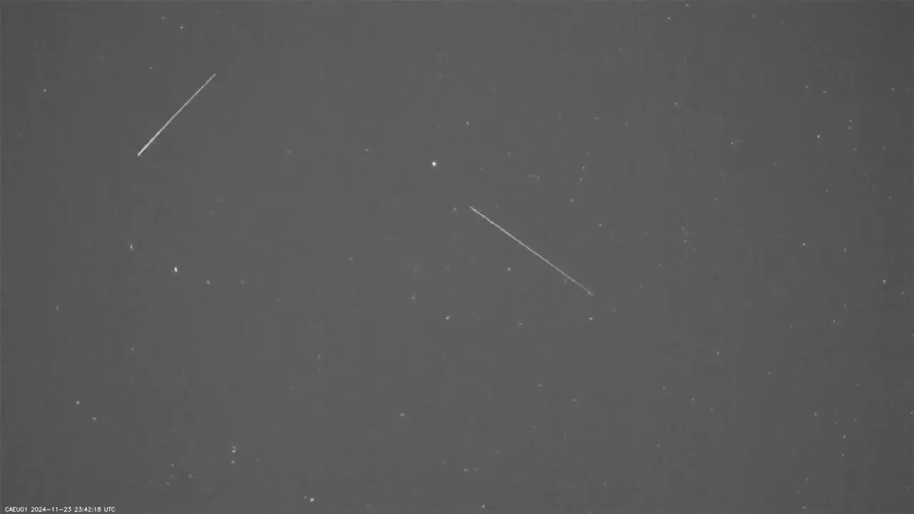
Researchers have captured the first-ever image of every single satellite streak blocking out the Arctic sky on one night.
This composite image, created from 14 different cameras, captures satellite activity over the Arctic sky on the night of February 22, 2025. The photo, taken in Eureka, located in the Canadian territory of Nunavut, shows individual satellite trails as streaks of light moving across the sky.

According to a report by Space.com, a team of researchers from Western University in Canada, working with Defense Research and Development Canada, traveled to the high Arctic in February to study satellite movement across the polar region.
Using 14 low-cost cameras arranged to cover the full sky, the team recorded satellite paths throughout the night. The resulting long-exposure photograph reveals the extent of satellite activity during that period. Each white streak in the image represents the trajectory of a satellite as it passes overhead. The tracking method was adapted from meteor observation techniques, with cameras positioned at various angles to capture the entire sky.
According to a press release by Western University, this new satellite monitoring system has enabled researchers to complete the first-ever full year of satellite tracking data over Canada. The system is currently deployed at four locations across Canada to monitor satellite activity including Eureka, Osoyoos, British Columbia, and Lucky Lake in Saskatchewan.
Western University says that the system is capable of detecting all Canadian and foreign objects passing over the country that are larger than 30 centimeters in size.

The cameras used are unique as they are very sensitive, monitor the entire sky, and collect images tens of times per second, meaning they can track satellite constellations, rocket bodies, and other debris in low earth orbit while continuing to monitor meteors.
So far, it has recorded nearly half a billion individual observations, covering more than 17,000 distinct satellites. The system regularly tracks over 90% of all active satellites crossing Canadian airspace in low Earth orbit — a region of space where satellites travel at altitudes below 2,000 kilometers.
“The rapid proliferation of mega-constellations of satellites, like Starlink, make it an urgent priority for Canada to have its own capabilities to persistently monitor wide swaths of space above the country,” Peter Brown, Canada Research Chair in planetary science and member of Western’s Institute for Earth and Space Exploration (Western Space) says. “At a relatively low cost, this system provides sovereign coverage of Canada’s north while greatly advancing the understanding of the state of the space environment.”
Brown says the team is tracking satellite brightness to assess their impact on the night sky and hopes to make real-time visibility data for mega-constellations publicly available in Canada within a year.
“We also get a good feel for how bright the satellites are and how much they might impact everyone’s view of the night sky over time,” Brown explains. “Our current plan is to make the brightness of mega-constellations as seen from Canada publicly available in near real-time within the next year or so.”
Image credits: All photos via University of Western and Defense Research and Development Canada.
Source link