Rivian partners with Google Maps for enhanced EV navigation experience

What you need to know
- Rivian’s new navigation system brings Google Maps’ fresh traffic and place information.
- It combines with Rivian’s design and EV-friendly functionality, providing drivers with accurate range estimates and charging scores.
- The system offers real-time rerouting, satellite imagery, and detailed place information.
- Rivian’s mobile app complements the built-in navigation, allowing users to view range estimates, share destinations, and access all-new place photos and descriptions.
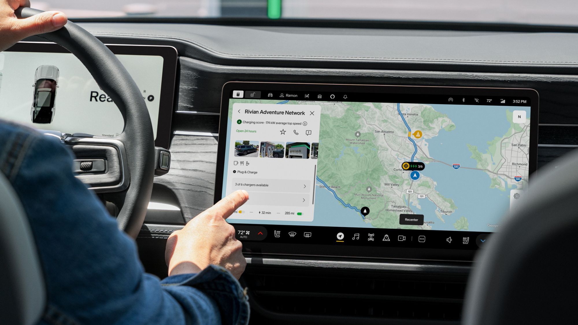
Electric car maker Rivian and Google Maps, together, have come up with a new navigation system to make the car owners’ experience a top-quality navigation.
The latest navigation upgrade should also mean a seamless, accurate, and helpful experience for Rivian drivers, the company notes in a shared press release. The partnership doesn’t mean the navigation system in Rivian cars is just Google Maps; instead, it is built on it. Meaning, the navigation system is specifically designed for Rivian cars.
According to the company, it comprises industry-leading mapping technology, fresh information from Google Maps, next to Rivian’s design and core EV-friendly functionality. Drivers are believed to have a better experience, like range on arrival estimates, charging scores, and charging stop selection.
Fresh information from Google Maps here comprises fresh traffic and place information, which further comprises giving users the fastest route irrespective of traffic or destination, keeping ETA accurate along the way, and rerouting instantaneously whenever a new, quicker option is available while en route. The traditional real-time information about road disruptions based on relevant reports from the Google Maps community is also available.

Google Maps already provides detailed information on places, like hours, photos, ratings, and place summaries. With the latest upgrade, Rivian drivers can tap on such places of interest right on the map and learn about hours, reviews, and contact information. Additionally, they can also take advantage of satellite imagery on Google Maps as part of the update.
Aside from Google Maps’ prowess, Rivian also incorporates its updated navigation for its cars alongside the mobile app, which includes range estimates tailored for specific vehicles as users drive and “factors in whether you’re using accessories, gear, or trailers.” Plus, users can also have the ability to view their range in percentage, distance, or both.

The built-in navigation further claims to curate charging stops, adding to the users’ trips and making them get faster trips, better chargers, and preferences per their charging networks, range on arrival, and more.
The networks here could comprise compatible networks next to Rivian Adventure Network, Tesla Superchargers, for example. Then there’s charging score, which is Rivian’s unique score derived from individual charging sites, based on plug-in data from the company’s vehicles, giving information on how reliable a charge station is.
All in all, Rivian users can experience a refreshed map look with enhanced natural spaces in its topography and colors, and have easy glanceability. Lastly, the mobile app also includes all-new place photos, place descriptions, and Satellite view (with a Connect+ subscription), and the ability to see traffic and traffic incidents. Also, riders will be able to share destinations and trips from the mobile app to the vehicle and outside the app via Google Maps.
Source link


