
How I Turned My 11,000km Odyssey Around the UK Coast Into a Photo Book

Long-distance walking has been a part of my life since I was ten, when my mum decided we should walk 480 kilometers from John o’Groats to Glasgow over the summer holidays. Despite never having done it before, walking every day immediately felt natural, and I was thrilled by the adventure of being immersed in nature and enduring.
After a long day by Loch Lomond, we spent the night sitting on the path under a silver survival blanket as we had no torch to reach our destination. Crouched beneath the crinkly cover, surrounded by the sounds of unseen animals in the pitch-black woodland, I wasn’t fearful – I was happy.

In the following years, I would travel further afield. As a photographer, my job involved capturing new landscapes, from the Arctic ice cap to the jungles of Borneo. Drawn to the wild and exotic corners of the world, I would come to visit over seventy countries. Still, every year I returned to Britain, where I found myself combining backpacking and photography – my two favorite pursuits. And it turned out there was as much beauty and inspiration to be found in the British countryside as there was abroad.


Gradually, I started taking on ever-more challenges, from walking the Southern Upland Way to the Cambrian Way, and producing photo series of each of my adventures. That is, until I contracted meningitis, which left me barely able to walk down the street without needing rest.
The idea to walk the entirety of Britain’s coast was born in 2014 as I slowly recovered. Being on bed rest, I craved the outdoors, and as soon as I got well enough, I planned a walk along the Thames, from its trickling source at Kemble in Gloucestershire to the Houses of Parliament in Westminster. Then, I walked along Britain’s longest river, the Severn, from the source to the sea.
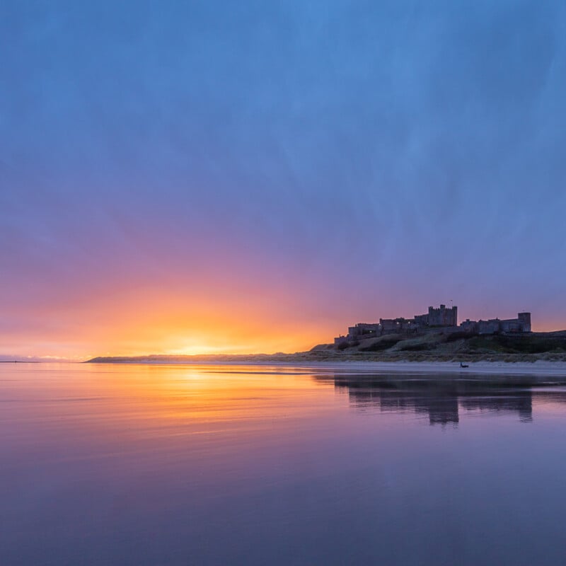
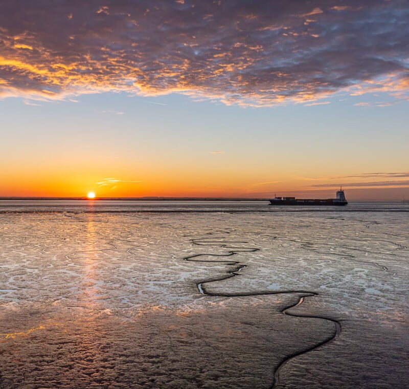
It was the first time I’d traversed a coastal area with my camera in hand, and I was captivated by the stark contrast between nuclear power stations and pylons sitting against a backdrop of vast expanses of tidal sands. I grew hungry to discover more of the coast, to capture this inspiring in-between world that was neither land nor sea. Why not walk the whole thing?

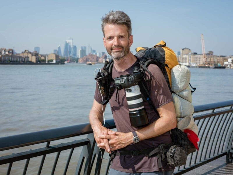
So, over the course of 454 days within the next five years, I walked 11,000 kilometers around the mainland coast of Britain in one-week to two-month sections. Armed with hiking and photography gear that weighed anywhere from 10 kilos in the summer to 24 kilos in the winter, I put one foot after the other, following paths along the coast and detouring inland only where necessary or to ascend the highest summits of England, Wales and Scotland (Scafell Pike, Snowdon / Yr Wyddfa and Ben Nevis).
In Scotland, where there were often no footpaths at all, I forged my own way, clambering over rocks and backtracking repeatedly when the ground got too steep or the vegetation too dense.


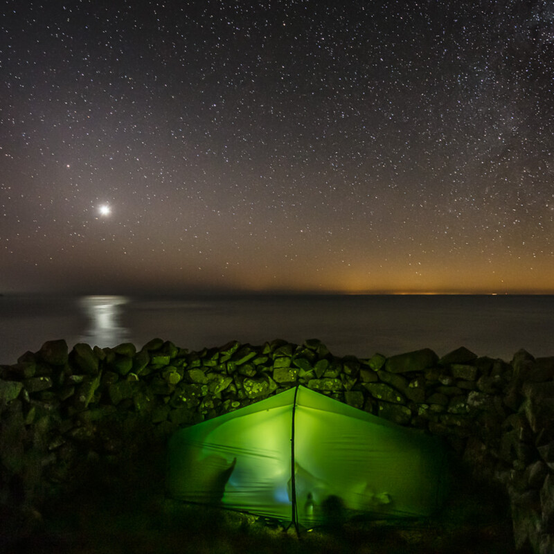
With my camping gear, power banks, food, and camera, I was fully self-sufficient and walked an average of 25 kilometers a day, sleeping in a tent to stay connected to the landscape. Most days ended with a litany of aches and pains as I refused any form of vehicle or mechanized assistance. But gradually, I began to adapt and accept the things beyond my control, like sore muscles, blisters, and bruising from backpack straps.
Later, when I developed overuse injuries that would take weeks to recover from, it was my curiosity about the people, landscape, and history of what lay ahead that kept me going.

There are a handful of derelict crofts on his land that once housed seven people that used to work with him. Today he manages the farm mostly alone “All the young ones leave after school now”. The Rhins, Dumfries and Galloway, Scotland.
Over the course of five years of walking and three years of editing, I took 179,222 images, subsequently culled to 12,000 favorites, of which over 1,300 have been curated for The Perimeter book. True to my experience, the finished project is organized by fifty-three chapters based on historic counties in the order that I walked them, starting in London from the steps of St Paul’s Cathedral on Friday 17 April 2015 and travelling clockwise.


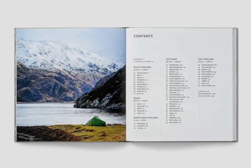
To capture the geographic scale of the coast, the length of each chapter varies depending on the distance I covered, so there is more content from longer counties like South Argyllshire, which has a coastline of 857 kilometers, and less from smaller counties like Midlothian, which has a coastline of 36 kilometers.


I photographed the project with a Canon 5DS R, which allowed me to see the 1:1 format I used in the viewfinder. The 51 megapixels of this camera work well for me as I make large prints to fund the project.
My initial image cull occurred in Lightroom, where I chose the best light and composition for a series of similar images. Identifying the duds was easy, but choosing the best between the final two best views of a subject was often agonizing. Once I’d picked the keeper in Lightroom, I adjusted tones and colour temperature and made judicious use of gradient masks.
My intention was always to create a natural tonal and color variety, ensuring the journey’s diversity came from the weather and geography, not from the processing. For example, the summer light in the north of Scotland was often much more saturated – on one occasion, the images looked so over-saturated out of the camera that I had to reduce it slightly so it looked realistic!


Soon, distinct themes began to emerge as I edited. Infrastructure captured my attention first – pylons, chemical works, bridges, and factories often appeared bizarrely out of place against the natural backdrop of the coastline, creating a striking contrast. The Welsh coast path was consistently fascinating – plumes of steam rising from the Port Talbot steelworks were as jaw-dropping as the stunning Worms Head on the Gower Peninsula. At Barmouth, the rail bridge runs like a zip across the landscape, with Cadair Idris and the surrounding mountains behind – the natural and the man-made in perfect harmony.

When I signed the book contract, I felt that about 13,000 of the photos were worth keeping. The book became a collaborative effort involving many creative voices. The publisher leaned toward accessible images, I preferred minimalist ones, the designer looked for visually striking shots, and both the editors and I wanted to include images with a touch of humor or eccentricity.
Each chapter called for a specific range of images—say, 20—but I’d provide up to 100, organized by themes like ‘landmarks’ or ‘quirky moments’ using a color-coded system so the graphic designer had some options to make the best layout. I lobbied for the more artistically compelling photos to be printed larger, and some of them were placed as full-page spreads opposite one another, reminiscent of traditional art books.
Writing the text took around seven months—more time than the final image selection and page layout.


Ultimately, I believe the book reflects a rich variety of tones and visual styles—echoing the sense of wonder and discovery that comes with setting out on a long-distance walk, camera in hand.
The Perimeter by Quintin Lake is published by Hutchinson Heinemann. It will be released on May 15th, 2025.
About the author: Quintin Lake is an award-winning photographer exploring landscape, architecture, and long journeys on foot. See more of Lake’s photos and buy prints at theperimeter.uk. You can also find him on social media @quintinlake.