CAMERA

Photographer Sends Up His Drone to Capture Iceland’s Unique Geothermal Landscape

A photographer has been sending up his drone above geothermal pools to capture abstract images of the colorful and textured hot springs.

Vilhelm Gunnarsson is a press photographer from Iceland, a country renowned for its abundant natural hot springs which is a direct result of its unique geological position straddling the Mid-Atlantic Ridge and sitting on a Volcanic hotspot.

The intense geothermal activity heats underground water, which then rises to the surface, creating natural hot springs and providing a sustainable energy source for the country.

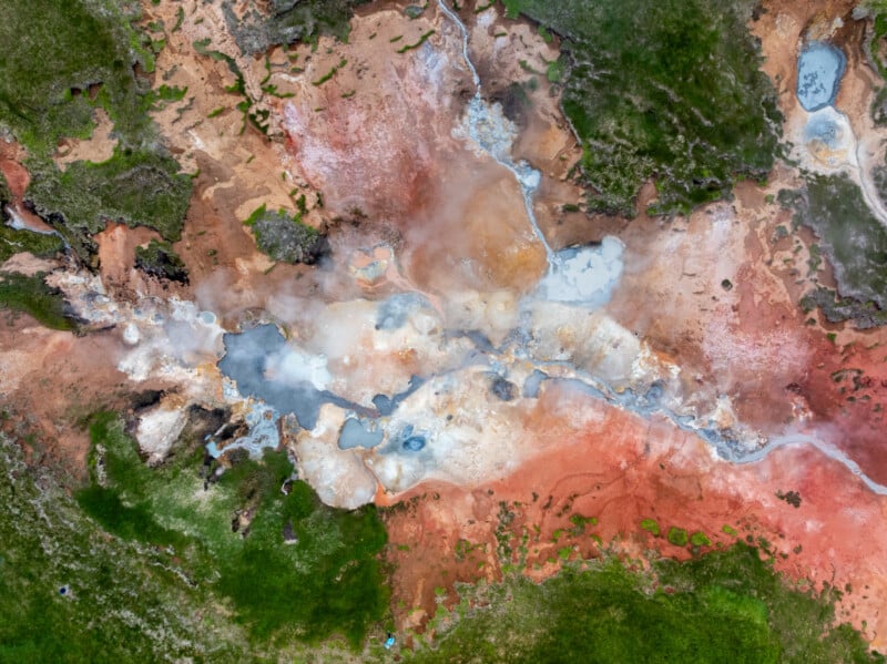
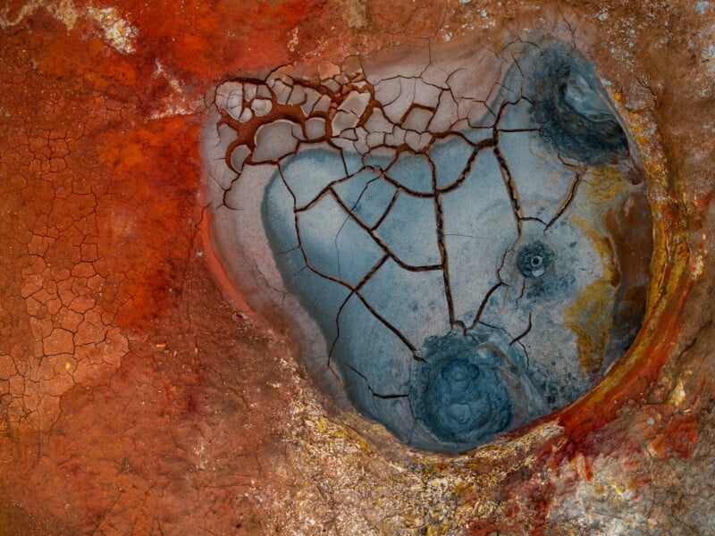
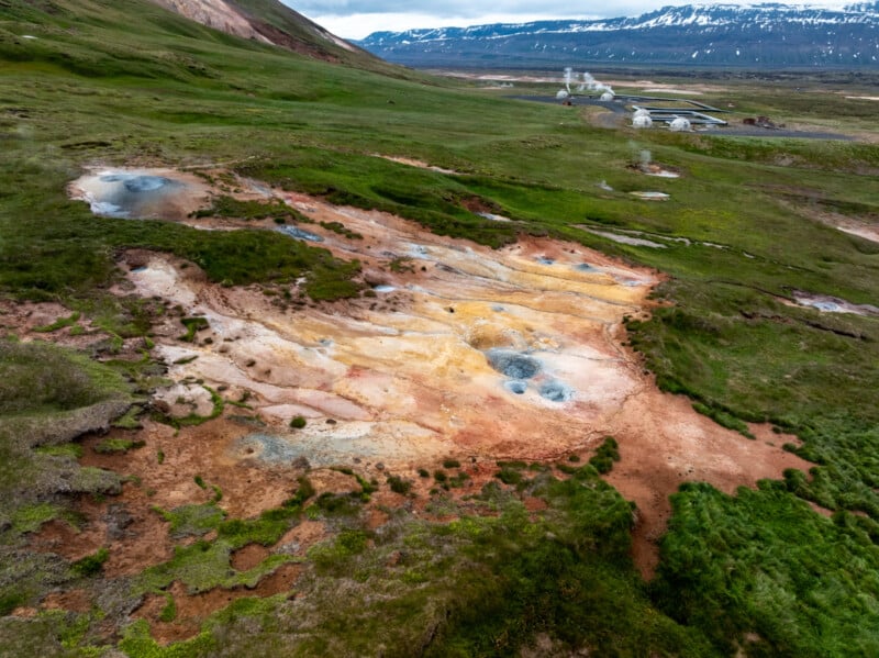
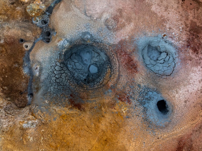
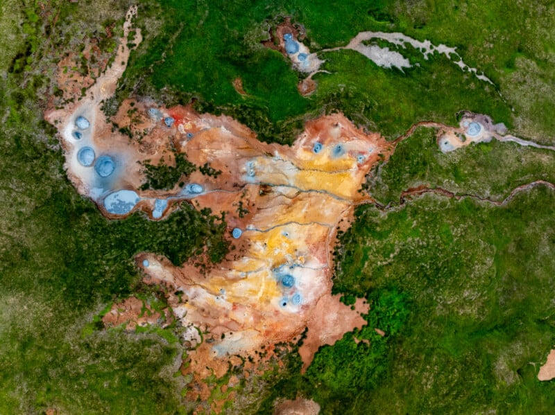
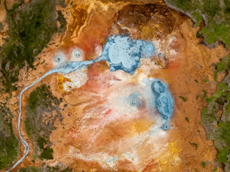
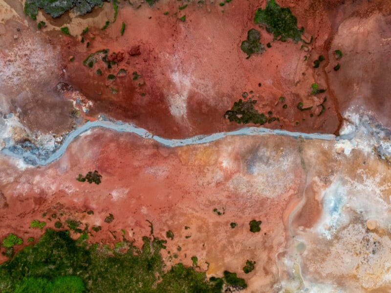
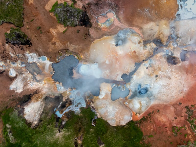
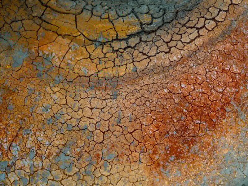
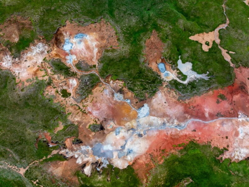
Gunnarsson visited a particularly colorful geothermal area in a part of Iceland called Þeistareykir that he says is a little off the beaten path, but is well worth a visit.

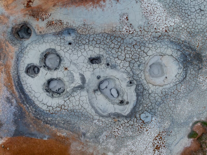
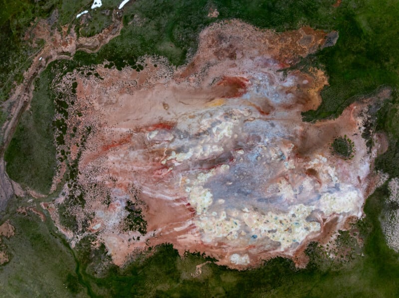
“At Þeistareykir you will find all kinds of hot springs and mud pools, fumaroles, and vivid geothermal colours. Here the earth is white and yellow, orange and bright red, brown and grey with fumes and emissions rising out of the earth everywhere you look,” he says.

Aerial view of a geothermal area with vibrant mineral deposits in red, orange, and white, steaming hot springs, and patches of green vegetation surrounding the colorful landscape.

A person stands near colorful geothermal hot springs with steaming vents, mineral-stained ground, and warm pools surrounded by green grass.

Aerial view of cracked, dry earth with several circular mud pools and patches of white and reddish soil, resembling a geothermal or volcanic landscape.

Aerial view of a large, multicolored geothermal area with patches of green vegetation on the edges and varying shades of brown, red, white, yellow, and gray across the surface, creating a textured abstract pattern.

Aerial view of a bubbling mud pool with cracked, dry edges and patches of smooth, grey mud in a geothermal area surrounded by orange and brown earth.

Aerial view of a cracked, dry mud pool surrounded by vibrant red, orange, and beige earth, creating an abstract, textured landscape with natural patterns and color contrasts.

Aerial view of a geothermal area with steaming vents, multicolored earth, patches of green grass, and distant mountains partially covered with snow.

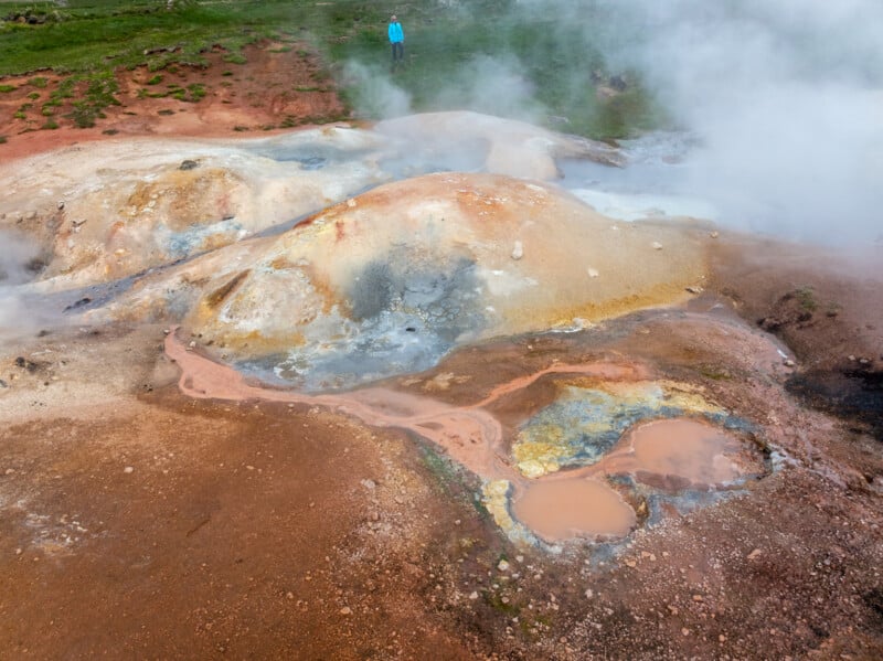
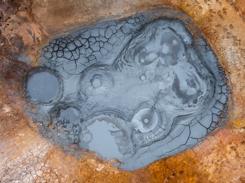
Gunnarsson captured the shot with a DJI Mavic 3 Pro drone, which he says makes it much easier to capture imagery of volcanic eruptions since it is possible to shoot straight down on the subject without getting too close.

“The drone also makes it much safer because some hot springs are 80-100°C (176-212°F) fed by geothermal water that can be as hot as 240ºC ( 464°F) below the surface,” explains Gunnarsson. “They are strictly look and don’t touch! Also, if people get too close, they leave footprints in the mud.”

Aerial view of a geothermal area with cracked blue-gray mud pools, surrounded by reddish-brown and yellow earth, showing textured patterns and mineral deposits.

Aerial view of a colorful geothermal area with orange, yellow, and brown mineral deposits, scattered blue hot springs, and green grass surrounding the unique landscape formation.

Aerial view of a geothermal hot spring with vivid orange, yellow, and green mineral deposits, blue steaming pools, and surrounding patches of green vegetation.

Aerial view of a colorful, textured landscape featuring red, orange, and brown earth with patches of green vegetation and a narrow, winding gray stream running through the center.

Aerial view of a colorful geothermal hot spring area with steaming pools, mineral deposits in white, orange, and blue hues, and patches of green vegetation at the edges.

Cracked, dry earth in shades of brown, orange, yellow, and gray, forming an abstract, textured pattern that resembles a parched landscape or dried paint.

Aerial view of a geothermal landscape with vivid green grass, rust-red soil, white mineral deposits, and small blue pools connected by winding streams. The terrain displays striking natural colors and abstract patterns.

Gunnarsson says he didn’t need special permission to use the drone at these locations. However, there are nature reserves in Iceland that require permits.

“In Iceland, there are rules for drones, and it’s also important to think about other people who want to enjoy nature without a drone flying over their heads,” he adds. “I was alone in that place, so I got plenty of time to fly over.”

Gunnarsson has previously appeared on PetaPixel for his dramatic photos showing volcanic lava engulfing parts of the Blue Lagoon, a popular tourist geothermal spa. And, he captured the reaction of tourists as they see a volcanic eruption for the first time.

More of Gunnarsson’s work can be found on his website and Instagram.


Image credits: Photographs by Vilhelm Gunnarsson


Source link

Related Articles

Back to top button